The engagement platform for environmental action
Turning fragmented data into real world impact.
Environmental work often gets buried in dense reports or scattered across disconnected tools. Organizations struggle to show their impact, and communities find it hard to access the data they need.
OJAI recognized this gap. They wanted to create a digital space where knowledge meets action. LogicLeaps partnered with them to build exactly that — a unified platform that combines geospatial mapping, community networking, and AI driven insights to help changemakers protect our oceans and environments.

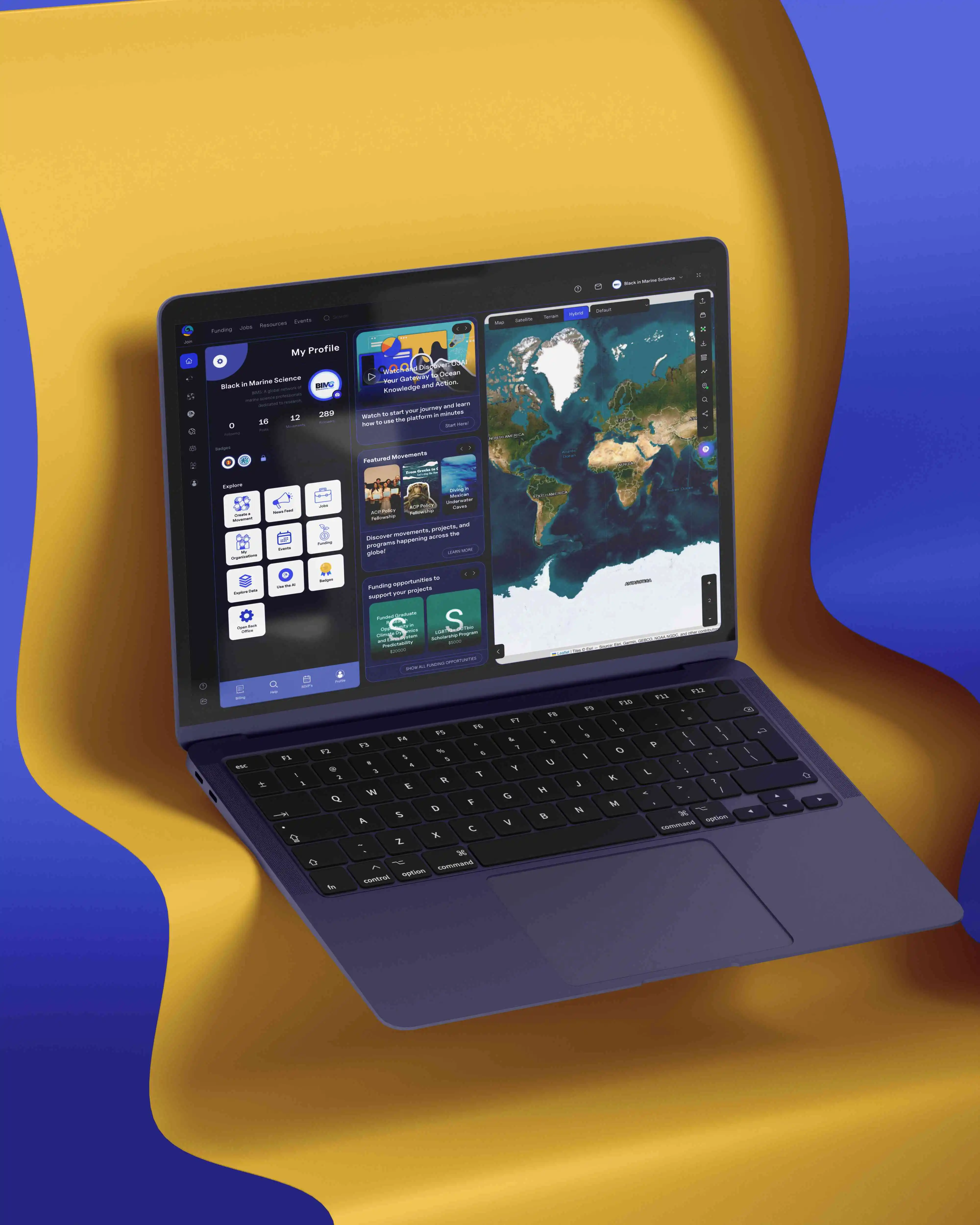
Data, mapping, and community all in a single hub instead of scattered spreadsheets and tools.
Community engagement, geospatial mapping, and shared knowledge working together in one experience.
Real-time integration with NOAA and EPA datasets keeps insights current and trustworthy.
Drop pins, upload local photos, and visualize environmental impact directly on the map.
A plain English chat interface translates complex environmental data into clear, actionable answers.
Profiles, organization directories, and event discovery boards connect changemakers in one place.
Curated resources and educational content help organizations and communities learn as they act.
Event and opportunity boards connect environmental groups and volunteers across regions.
Challenges
Let's break it down
Three problems stood between OJAI and the platform they envisioned. Here's what we had to solve.
Making sense of scattered data
Environmental data usually lives in complex spreadsheets or government databases that are notoriously difficult to navigate. Local advocates and community leaders often lack the technical resources to find and interpret this information. OJAI needed a way to pull all this fragmented data into one visual, accessible place.
Every new dataset meant another login, another file format, another learning curve. Advocates were spending more time wrangling exports than acting on what the data actually showed, and the insights that mattered most stayed buried three tabs deep in a government portal.
Breaking down technical barriers
Most existing geospatial and data analysis tools are built for scientists. Regular users hit a wall when trying to map local pollution or track restoration efforts. The challenge was building a platform powerful enough for researchers but simple enough for a local volunteer to use without reading a manual.
Off the shelf GIS software assumes a technical background most community organizers simply don't have, and don't need. OJAI needed an interface that felt as approachable as a social app, while still handling the layered, geocoded datasets researchers depend on underneath.
Connecting a fragmented movement
Environmental organizations often work in silos, using different platforms for event management, networking, and data sharing. OJAI wanted a centralized space — a dedicated community hub that didn't just host profiles, but actually connected people based on shared geographic and environmental interests.
A volunteer in one watershed had no easy way to find an aligned organization two counties over, even when they were tackling the exact same problem. Without a shared hub, momentum stayed local instead of compounding into something bigger.
Solutions
Here's what we built
Interactive geospatial mapping
People understand visual stories much better than spreadsheets. We built an interactive map platform where users can drop pins, upload local photos, and visualize complex datasets right on the map. Whether it's tracking illegal dumping sites or monitoring coral reef restoration, the community can now see the exact geographic impact of their work.
AI powered data interpretation
We integrated a natural language AI chat interface directly into the platform. Users no longer need a data science background to understand environmental metrics — they can simply ask the AI questions in plain English, and the system translates complex NOAA and EPA data into clear, actionable insights.
A purpose built community hub
We designed the platform to act as a central nervous system for environmental action — dedicated spaces for user profiles, organization directories, and movement groups. Users can discover local events, share funding opportunities, and collaborate on projects without juggling five different communication tools.
Results
From hidden data to collective action
LogicLeaps helped transform OJAI from an idea into a fully functioning ecosystem. We built a platform that simplifies complex data and gives environmental advocates the tools they need to drive real policy change. The project proves that when you give communities the right technology, you amplify their impact.
Got a product idea worth protecting?
Whether it's environmental impact or an entirely different industry, we build platforms that turn scattered data into action.